

HYPACK® SURVEY: Data Collection Software

HYPACK® SURVEY allows you to outfit additional survey vessels at a lower cost. It contains the programs for survey design and single beam data collection. It does not include the programs for editing the data or for generating final products.
Features
Simple to use survey planning for line creation, with support for worldwide geodesy models
Real time navigation display, support for remote helmsman and survey view
Processing tools allow for simple to use data cleaning, with both manual and automatic filters
HYPACK® data files are easily exported to XYZ, CAD, DXF and dozens of other formats
Specifications
Anchor and Tug Management available
Tools for creating contours, computing volumes, creating sidescan mosaic and electronic charts (ENC) are part of the package.
Over two hundred sensor inputs provide the connection for all types of GPS, Inertial systems, echo sounders, sidescan and sub bottom, magnetometers, velocity sensors and more
Applications
Suitable for all hydrographic survey operations
-
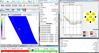
HYPACK HYSWEEP®: Data Collection and Processing Software for Multibeam Sonar and Lidar Systems
Survey Equipment -
QPS Qimera: Multibeam Data Processing Software
Survey Equipment -
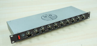
UG: Uni-PPS Splitter
Survey Equipment -
QPS Qinsy: Survey Planning, Acquisition and Processing Software
Survey Equipment -
Teledyne CARIS HIPS and SIPS™: Hydrographic Data Processing Software
Survey Equipment -
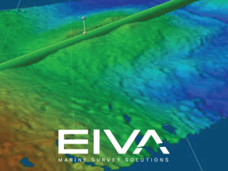
Eiva NaviSuite Nardoa
Survey Equipment -
Geometrics MagLogLite™: Data Logger and System Controller
Survey Equipment -
Chesapeake SonarWiz: Processing Software Dongle
Survey Equipment